


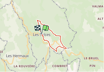


14.2 km | 18.7 km-effort

User


FREE GPS app for hiking
 SityTrail
IGN / Geographical institutes
SityTrail World
The world is yours!
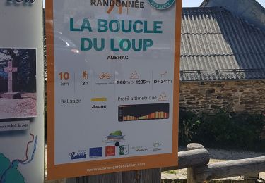
Trail Nordic walking of 10 km to be discovered at Occitania, Lozère, Les Salces. This trail is proposed by mdauzat.
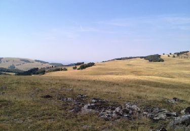
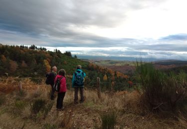
Très beau parcours, alternant larges prairies où paissent paisiblement de belles vaches, points de vue panoramiques, et long passages en sous-bois, tantôt résineux, tantôt feuillus... et, tout du long, d'innombrables rus et petits torrents dont certains descendent en cascade. Pas de grosse difficulté sur ce circuit, mais plusieurs "grimpettes" sympathiques à aborder sereinement.
Du beau parking au centre du village (à côté de l'église) passer devant le monument aux morts puis descendre sur la D52. La suivre sur la gauche, passer le pont sur le ruisseau du Taillat, puis, 100 m plus loin, prendre à gauche le chemin de gauche (GR60A) ; laisser deux chemins sur la droite et virer à droite à la bifurcation suivante. Au prochain carrefour, avant un réservoir, descendre à droite jusqu'à la D52. La suivre à gauche puis prendre la D56 sur environ 50 m.Prendre en face, sur le chemin de terre puis à gauche en lisière de bois. Dans le bois, à une intersection, descendre jusqu'à Pierrefiche. Traverser le village par la D56, puis prendre la petite route sur la gauche qui monte au col des Quinsous. Prendre le chemin à gauche entre les pâtures. Passer devant un chemin à gauche et atteindre un bois de résineux. Tourner à droite, puis à gauche, et continuer le long du bois jusqu'à la Croix du Loup. Suivre la piste à droite sur environs 200 m. S'avancer sur le chemin de gauche, qui traverse le bois (Bouos de la Gleize). Continuer sur le sentier, laisser deux sentiers à gauche. Traverser le ruisseau, puis descendre vers les Salces (ne pas repartir à droite sur le chemin qui tourne et s'éloigne : le panneau indicateur est tombé et n'est plus lisible). Continuer en lisière du bois jusqu'au village.


24 photos in total. Please click on a photo to see them all in the gallery.
Nordic walking
Walking

Walking
Walking
Walking

Nordic walking

Walking
Walking